Solutions
Our solution allows scalability planning, resource optimization
and integration with other tools
By combining powerful dataflow programming with design automation we also provide
Extended Automated Solutions to implement full, personalised, end-to-end automation solutions.
Solving Business Problems
Use Automation to take informed decisions
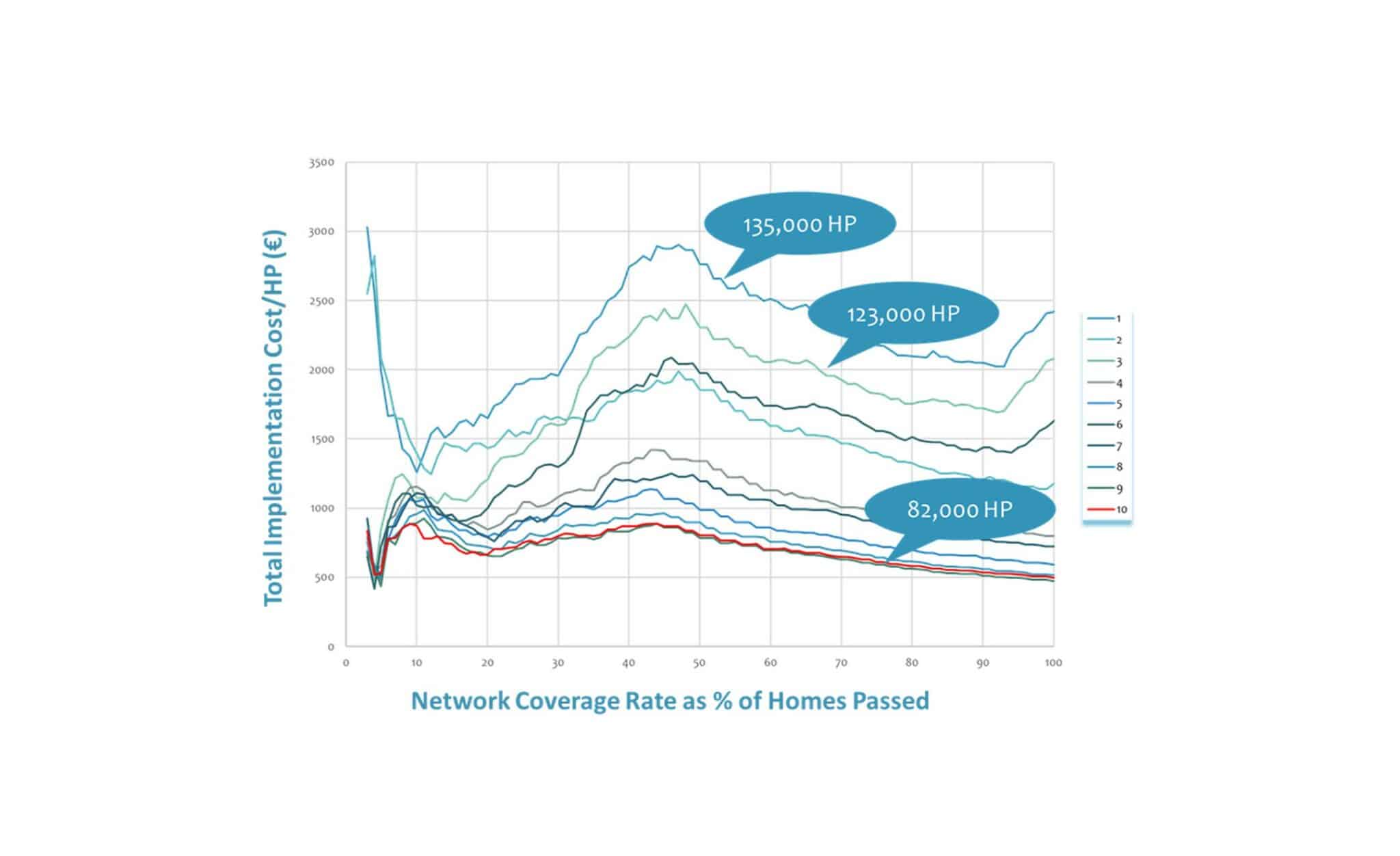
The Business Case
- Extremely powerful for building the investment case
- Impossible to be done manually with equivalent
speed and accuracy - Focusing on best opportunities by quickly evaluating
scenarios and feasibility of projects - Reliable data-based reports
Use Automation to accelerate Design to Build
The Engineering Case
- Releasing valuable internal resources (> 50% resources) from multiple activities without compromising on quality with cost optimization, and up to 80% time saving, and overall faster delivery
- Scalable at regional and national levels
- Adaptable to international engineering rules and standards

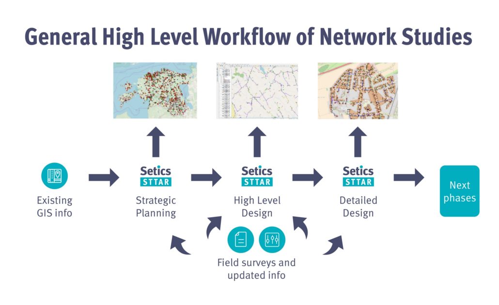
From Strategic Planning
to Detailed Design
Sttar ftth automated design process solutions cover the full scope of network studies, from strategic planning to detailed design. Setics Sttar also integrates with 3rd party solutions providing Field surveys solutions, GIS systems, Physical Inventory Management software and more.
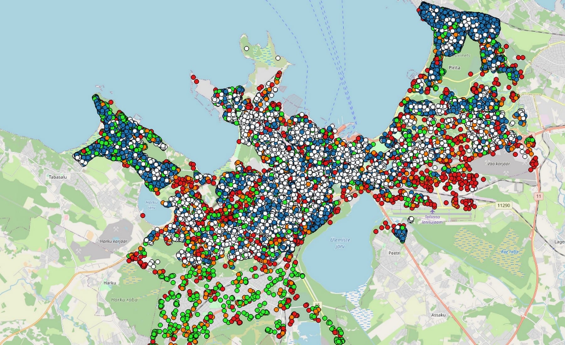
Powerful Strategic Design
and HLDs
Setics Sttar can handle very large areas such as entire regions or even countries and create comprehensive data models -GIS layers, bill of materials, various reports, etc. Tools are provided to further drill down into the generated model to answer various business questions about budget, scope, phasing, type of infrastructure used etc.
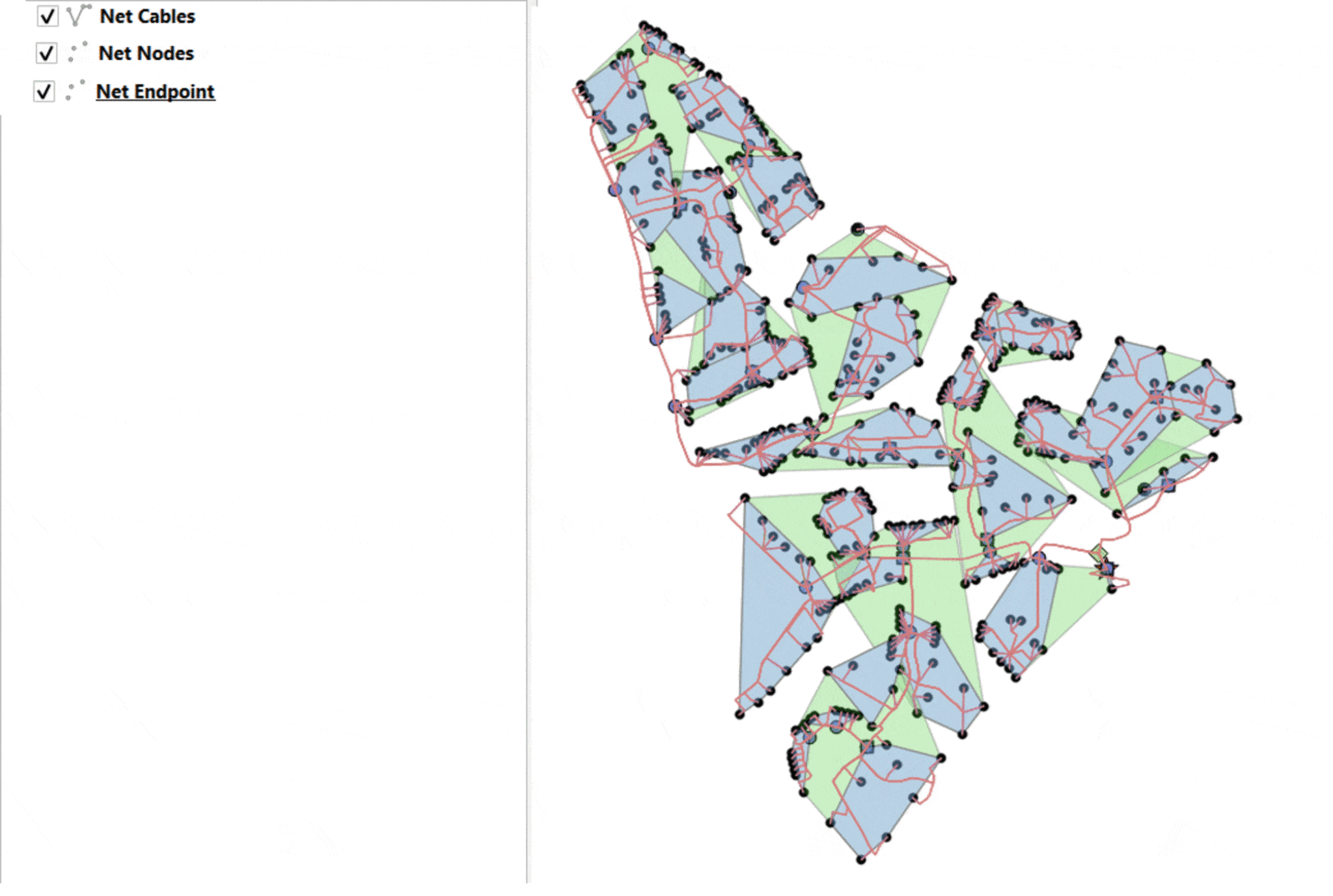

Performing
LLDs
Setics Sttar integrates a cartographic interface, which allows the user to visualize and modify the network, thanks to network-oriented tools, providing superior savings in the tuning of the design. Moreover, working with external GIS desktop software is possible for benefiting from advanced GIS functionalities.
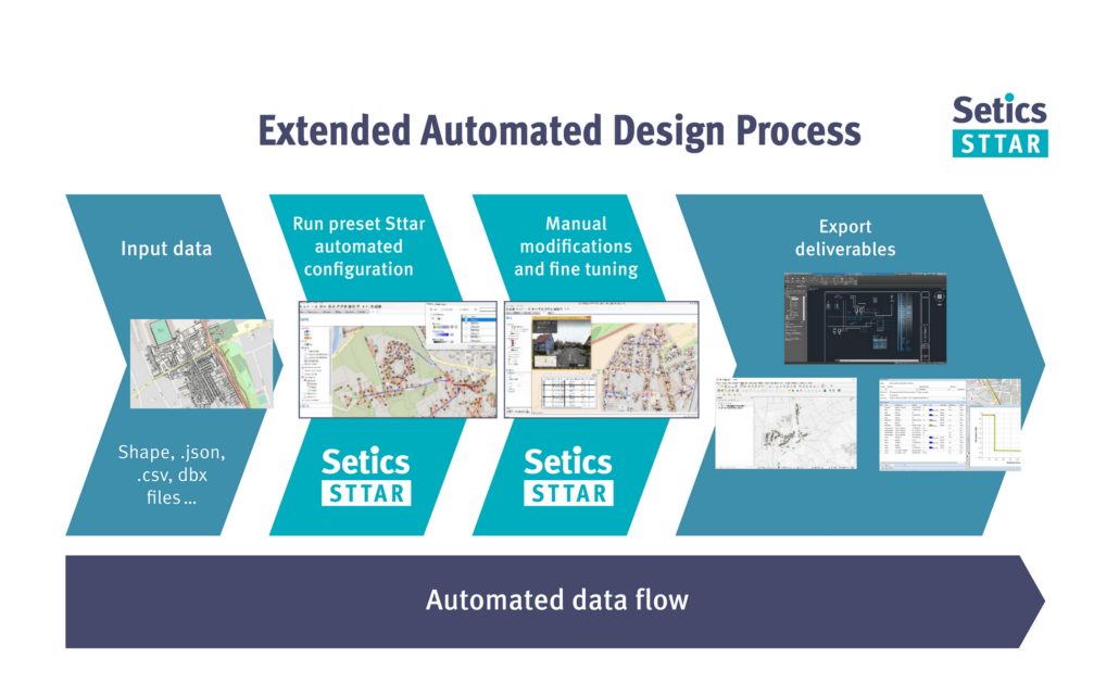
Extended Automation
Solutions
For clients that consider mastering the full scope of the plan-design-build process, we also provide Extended Automated Solutions to implement full, tailored, end-to-end ftth automated design process solutions.

Setics Sttar Software Suite
Setics Sttar software suite comprises several products
to address the variety of needs of our customers

Setics Sttar
Advanced Designer
To conceive and run automation configuration.

Setics Sttar
Planner
For the everyday work of detailed design on areas where automated or semi-automated work is required by regular designers.

Setics Sttar
Batch Engine
To run model automation on batches of projects in a fully automated way.
Setics Sttar
OnCloud
The Amazon hosted backend model automation solution for 3rd parties GIS solutions.